
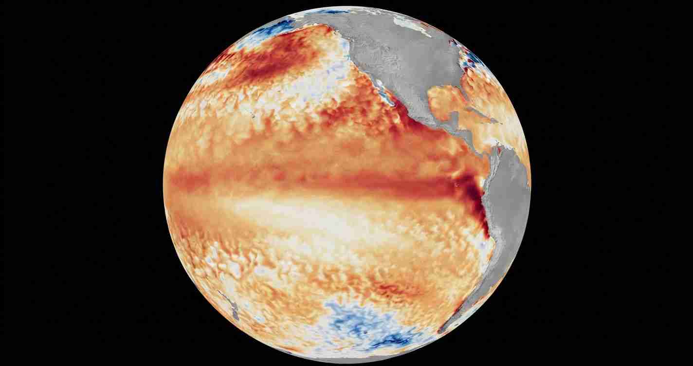
WASHINGTON, July 7 (San Diego News Online) — NOAA forecasters say El Niño conditions are now present and are expected to strengthen into the Northern Hemisphere winter of 2026-27.
In its June 11 ENSO Diagnostic Discussion, NOAA’s Climate Prediction Center issued an El Niño Advisory and said the latest weekly Niño-3.4 index was +0.7 degrees Celsius. The center also reported +0.7 degrees Celsius for Niño-4 and +2.1 degrees Celsius for Niño-1+2, a sign that above-average sea-surface temperatures are spreading across the central to eastern equatorial Pacific.
For readers in Washington, D.C., the practical takeaway is to keep an eye on NOAA seasonal outlooks and local weather updates through the months ahead. El Niño is a large-scale climate pattern in the Pacific, not a local storm warning for the capital. But it can change the odds of winter temperature, rain and storm tracks across the United States, and NOAA’s Ocean Service says it can also increase the chance of high-tide flooding in some coastal areas.
What is El Niño?
El Niño is one phase of ENSO, the El Niño-Southern Oscillation, a recurring cycle of warming and cooling in the tropical Pacific. When NOAA says El Niño conditions are present, it means the ocean has warmed enough in the key equatorial Pacific region to meet the agency’s criteria.
NOAA says these conditions developed over the past month after above-average sea-surface temperatures first appeared in the far eastern equatorial Pacific in early February and then expanded across the central and eastern Pacific by mid-April.
Why forecasters expect it to grow
The Climate Prediction Center says model guidance, including the North American Multi-Model Ensemble and the NCEP CFSv2, points to further strengthening through the winter. NOAA’s advisory says there is a 63% chance of a very strong El Niño during November-January, which the agency says could rank among the largest events in the historical record back to 1950.
That does not mean a specific storm, cold snap or wet spell is guaranteed. It means the odds are tilting toward a stronger Pacific signal that can influence weather patterns over a broad area.
What it could mean for the U.S.
NOAA’s Ocean Service says El Niño can contribute to higher high tides and more flooding in some U.S. coastal areas. The effect is not the same everywhere, and it is not a separate local warning for Washington by itself. It is a national forecast story about a Pacific pattern with possible downstream effects.
For people following weather in the months ahead, the most useful step is to check NOAA’s seasonal outlooks and the National Weather Service forecast for the area that matters to them. El Niño changes the odds; local forecasts still decide what actually happens day to day.

